
This Memorial Day (5/31/10) Wade, Iggy and I headed out to see what it was all about at Settler's Cabin Park. It was quite a hot and humid day - but we decided to pack a picnic lunch and check it out anyway.
Settler's Cabin is a 1,589 acre park in Allegheny County, Pennsylvania, located about 15 miles west of Downtown Pittsburgh. Archaeologists from Carnegie Museum of Natural History helped identify the origins of the 1780 log cabin that gives Settlers Cabin Park its name. All dogs are welcome, as long as they remain on a leash.
 There are four major trail loops that make up the blazed hiking trails at Settler's Cabin:
Tepee Loop - Red 1.5 mi
Blue Loop - Blue 2 mi
Green Loop - Green 2 mi
Purple Loop - Purple 1.4 mi
Blue Loop/Tepee Loop
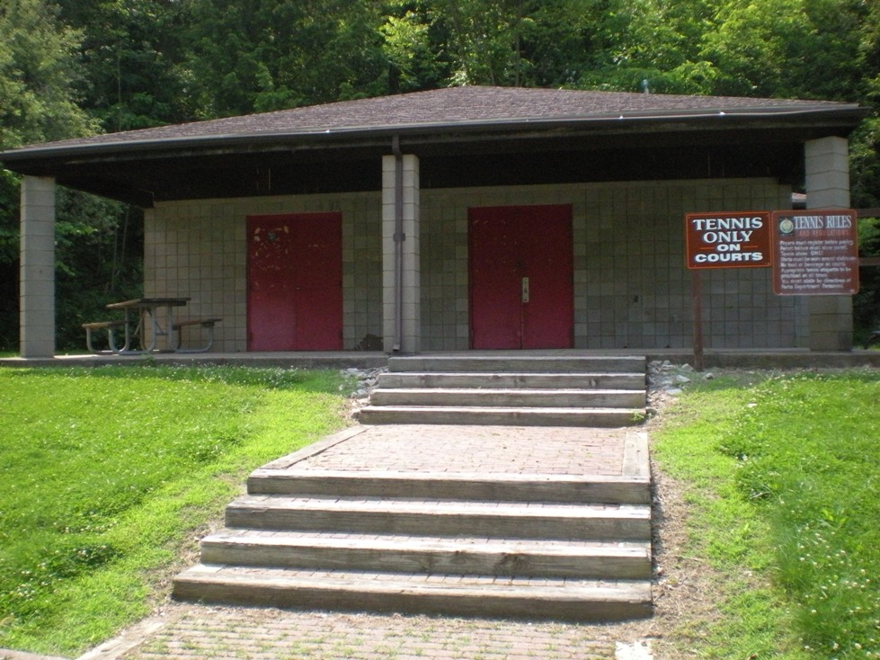
The most direct access to the Blue Loop is via the tennis courts parking lot - however the trail head is not visible from the parking lot. This is the only Blue Loop access that is not part of the picnic pavilion loop. If you park facing the building between the courts and playground, the trail runs along the edge of the lot. The trees and light poles are blazed with blue at this point.

The only part of the Blue Loop that has no blazes is in a large mowed grass field next to the tennis courts. If you start in the tennis court parking lot, the blazes will disappear just after you pass the courts and enter the field. Look for the Tepee Loop sign (see Iggy above) and you will see a path in the high grass. Follow it to the left of the sign and the blazes will reappear when you enter the woods.
The two loops will share the same trail until they split where the trail emerges from the woods at Tomahawk Shelter.
Green Loop
The Green Loop has a long overlap with the Blue Loop (2500 feet). The Green Loop, after it splits off from the Southern end of the Blue Loop, goes through a large stand of mature forest and has some of the best scenery in the park. This leg of the loop has a steep climb and a spring, which drains into the trail -turning it into a small stream for days after a storm. The footing can be difficult when the packed earth slope is wet.
There is a small waterfall next to the trail on the way down the hill. The trail blazes have been routed to the side to provide a view of the valley and falls. After the trail reaches the valley floor, it follows a stream for about 900 feet before it crosses and climbs. Make sure to look for green blazes and stay on the trail at this point - we got lost for a moment and went up to the road. If you reach the road - turn around and go back, there is not much of a shoulder and there are dangerous blind curves.
The trail to the top is a very steep mountain bike trail. The blazes leave the trail and take a route that is less steep, then rejoin the trail at the top of the hill. This is the only major drop and climb on the loop. The Green Loop parking lot closest to the park entrance is the Tomahawk Shelter lot. Use the Blue Loop as an access trail to Green.
Purple Loop
The Purple Loop is relatively level and extremely well marked. The only hill is on a pipeline trail that intersects the Green Loop at the Northern end of the Purple Loop. It is not an extreme grade, and if you walk the loop in a clockwise direction, it will be a descent, instead of a climb.
The only way to reach the Purple Loop via blazed trail is by using the green loop. For the shortest Green Loop connection to Purple, park in the Arrowhead shelter lot at the Southern end of the picnic pavilion drive. Use the access trail from the parking lot and turn left when it intersects the Green Loop.
Summary:
 Overall we found this set of trails enjoyable, as well as a nice workout. Iggy had no problems with the terrain and only ended up with one tick despite rolling in the large sections of tall grass. ---->
I would suggest bug spray on a humid day for humans.
Drawbacks: it seemed that none of the water fountains we encountered were in service, and did have some trouble finding a trail blaze or two along the way.
Trail Difficulty Rating: 2
Blazing/Marking Rating: 3.75
Trail Condition Rating: 3
Facilities Rating: 3
Dog Friendliness Rating: 5
Tick Count: 1
Overall Rating: 3.35
Blazing/Marking Rating: 3.75
Trail Condition
 Rating: 3
 Facilities Rating: 3
Dog Friendliness Rating: 5
Tick Count: 1
Overall Rating: 3.35
Settler's Cabin Park - Allegheny County Parks Site:
http://www.alleghenycounty.us/parks/scfac.aspx
Settler's Cabin Park - Park Map (downloadable PDF):
http://www.alleghenycounty.us/parks/maps/scmap.pdf
Wikipedia - Settler's Cabin Park:
http://en.wikipedia.org/wiki/Settler%27s_Cabin_Park
Please Note: Some references and wording was taken from the above websites.


No comments:
Post a Comment